Google Remakes Satellite Business, By Leaving It

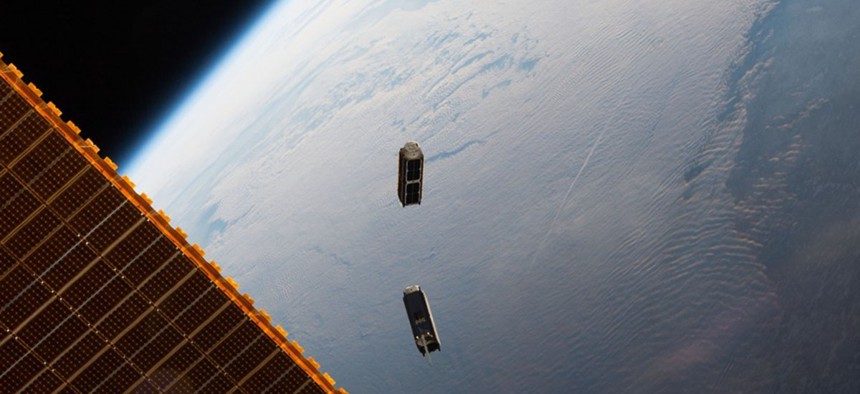
The International Space Station deploys two Planet “doves” in May 2016. NASA
A startup says a 50-trillion-pixel image of Earth, refreshed daily, is coming later this year.
Last week, Google pushed one of the most interesting sectors in Silicon Valley toward maturity—and brought a milestone in cartography closer to reality. It accomplished all that, paradoxically, by getting out of the market.
From a business standpoint, here’s the news: Google sold its in-house satellite business, known as Terra Bella, to Planet, Inc. Planet is a startup based in San Francisco that already operates a fleet of 60 orbiting cameras the size of shoeboxes. With the acquisition, Planet is now the de facto leader in the small-satellite space, and it will add Terra Bella’s seven high-resolution satellites to its own constellation of medium-resolution craft.
As part of the deal, Planet will give Google access to its growing archive of imagery for at least the next few years.
But the more interesting development has less to do with acquisitions and more with technological capacity. Planet also announced it will deploy 88 small satellites later this month, as part of a rocket launch from Satish Dhawan Space Centre in southeastern India on Feb. 14. Assuming most of the spacecraft make it to orbit intact, these satellites should become fully operational by the summer.
When that happens, Planet will be the first to hit a long-discussed milestone in the industry: It will photograph every place on the entire planet every day. Every park, every rice paddy, every patch of pine and permafrost: all will be imaged anew, daily, at medium resolution.
Planet says the India launch will break the record for most satellites deployed on a single rocket. Launches remain one of the most costly aspects of the space business, and the company has gotten burned for its frugality before. Its leaders know, from firsthand experience, that not all its satellites will survive the journey to space. In October 2014, Planet became the first company ever to lose 26 satellites at once when an Antares rocket exploded on the tarmac. Nine months later, it lost another eight spacecraft when a SpaceX rocket failed before it left the atmosphere.
But if even a minority of the satellites make it into orbit, Planet will operate the largest private satellite constellation ever built. The Iridium Communications constellation, which encompasses 72 satellites, holds that title now (though Iridium’s satellites are more expensive than Planet’s and they orbit farther from Earth).
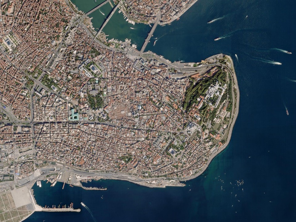
This constellation will have two components. A standard Planet satellite, which it calls a “dove,” is cheaply made. It is essentially an extra-large Cubesat, a widely used standard for building small spacecraft. It captures pixels that are three meters to a side. Each of the seven Terra Bella satellites, on the other hand, is about the size of a dorm-room fridge. A Terra Bella satellite detects pixels that are 90 centimeters to a side under good conditions.
“You can use the medium-resolution constellation to scan the planet every day, and then—say you see a plane crash or a flood in a town—you can use the high-resolution satellites to snap those changes,” says Will Marshall, co-founder and CEO of Planet.
He said the dual-layered constellation opened up new capabilities for the company.
“If we see a change in the middle of Siberia, in some field, we won’t point the high-resolution satellite at that,” he told me. “But if we detect some change in downtown Kiev, it might be good to have a high-resolution image. ”
The sale and acquisition caps off half a decade of growth and turmoil in the sector. When I first wrote about the small-satellite industry three years ago, it seemed a rare locus of hardware innovation in a software- and services-obsessed technology industry. Earth-observing satellites require, at minimum, high-quality image sensors and reliable radio antennas. The smartphone boom had transformed both: Thanks to economies of scale and foreign electronics manufacturing, the bare technological components of a satellite had become both cheap and nearly industrial-grade.
Taken together, this allowed companies to build much cheaper satellites. Unlike legacy players in the business, which build a single satellite worth tens of millions of dollars over the course of years, a startup could build lots of small satellites fast and hurl them into orbit. Losing a satellite during launch, which was once cause to ready a company’s obituary (or at least its legal team), would now become a point of pride.
“If you never lose a satellite, you’re not pushing the envelope,” Marshall told me at the time.
The two frontrunners in the industry were firms called Skybox Imaging and Planet Labs. Skybox planned to build a small fleet of medium-sized satellites that could capture high-definition video of Earth. Planet Labs, on the other hand, wanted to flood the lowest reaches of orbit with shoebox-sized cubesats.
You might be able to figure out where this is going. In June 2014, Google purchased Skybox for $500 million. It relocated the company closer to its campus, then rechristened it Terra Bella in March 2016. Meanwhile, Planet Labs bought the German satellite company BlackBridge. It kept sending rounds of new Cubesats into the sky. Eventually, it dropped the “Labs” from its name.
Planet and Terra Bella—the two firms that, under different names, defined the industry three years ago—are now one organization. Planet is now the obvious front runner, and the sector is its to define.

(Planet)

(Planet)
Not that the game is over. DigitalGlobe, a $700-million public company that provides much of the base imagery for the U.S. government and Google Maps, remains the juggernaut in the remote-sensing space. Its newest WorldView satellites have nine-times the resolution of the best Terra Bella craft. They are also the size of small trucks.
Last year, the company signed a deal with the technology accelerator for the Kingdom of Saudi Arabia to build a private constellation of Earth-observing small satellites. It’s possible to imagine a future where DigitalGlobe takes its own small-satellite, medium-resolution image of Earth everyday—except it will be augmented by the military-grade imagery of the WorldView constellation.
There are smaller competitors as well. BlackSky—which, in an industry built by spooks, somehow still has far and away the spookiest name—released the first images from its first satellite in November. It says 59 more satellites will follow by the close of the decade.
Another startup, Spire, offers global weather forecasts through an orbiting Cubesat network. And no matter who “wins” in the space, other companies will clamor around the victors. Orbital Insight and Descartes Labs are two startups that sell computer-generated reports based on Planet’s satellite imagery. Their chief customers are financial firms, insurance companies, and farmers.
A complete image of Earth’s surface, updated daily—this has long been the promise of the small-satellite industry. When it’s finally achieved, it will be critical it help not only Goldman Sachs and Monsanto, but also humanitarians, climate scientists and land-rights groups. But it will also be crucial people appreciate all the exquisite specificity of the image.
Planet is already photographing one-third of the world everyday. Marshall said the most impressive part of the archive is how much it changes.
“We have this psychology that the Earth is static-ish,” he told me. “But I think that has a lot to do with maps we were brought up with, and the fact that the satellite maps we see online are static.”
He continued: “When we get an image down, whenever we compare it to the previous image we took of that same place a couple of days before—every time, we see changes. Either a tree has been taken down, a building has been added, a truck or a ship moves, and sometimes a river moves and you don’t notice it. A field is tilled. Things change every day in every picture we get.”


