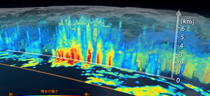
Here’s What a Cyclone Looks Like From Space—in 3D

NASA
NASA’s Global Precipitation Measurement mission returns its first images.
NASA's mission to measure every raindrop and snowflake on Earth is intended to save lives from killer storms and allow scientists to keep tabs on the planet's climate.
Turns out, it's also sending home some really cool images of storms from outer space.
The lead satellite for the Global Precipitation Measurement mission launched last month in partnership with Japan's JAXA space agency. It's part of a fleet of satellites that will help us learn about the water cycle, providing valuable information about storms, droughts, floods, and mudslides. The GPM mission will also track climate change's effects on Earth's precipitation.
On Tuesday, NASA released the first images from the GPM Core Observatory. They're of a March 10 cyclone over the Pacific Ocean. The images produced by radar and microwave imaging give us a unique three-dimensional look at the storm and the intensity of the rainfall within it.
"It was really exciting to see this high-quality GPM data for the first time," said GPM project scientist Gail Skofronick-Jackson in a NASA release. "I knew we had entered a new era in measuring precipitation from space. We now can measure global precipitation of all types, from light drizzle to heavy downpours to falling snow."


