Next-Gen Weather Satellite Goes Online; NASA Orders Two More for $460M

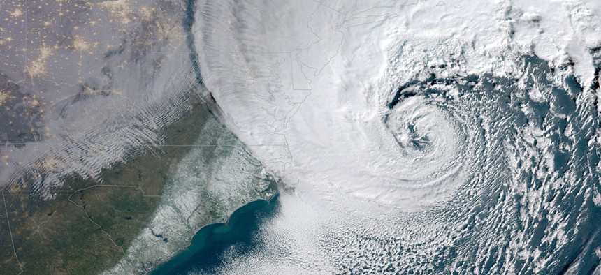
This satellite image provided by NOAA shows a powerful nor'easter winter storm moving up the U.S. eastern seaboard on Thursday, Jan. 4, 2018. NOAA/AP
The first satellite in the new Joint Polar Satellite System passed all its tests and is fully operational.
The newest polar orbital weather satellite, JPSS-1, has successfully completed its six-month check-out in orbit and is officially fully operational, the National Oceanic and Atmospheric Administration said Wednesday.
JPSS-1 is the first of the new Joint Polar Satellite System to go online. The craft was launched in November and renamed NOAA-20 when it achieved orbit. A second polar satellite, JPSS-2, is currently being designed and built by Orbital ATK, with a launch scheduled for 2021.
The JPSS-1 and its older sister, the Suomi NPP, circle the Earth 14 times a day in latitudinal arcs that provide imagery of the entire globe twice a day.

“NOAA-20 is especially beneficial for tracking developing storms in the Arctic, Alaska and Antarctica,” said Neil Jacobs, assistant secretary of commerce for environmental observation and prediction. “Forecasts for these remote regions are critical for the U.S. fishing, energy, transportation and recreation industries, which operate in some of the harshest conditions on the planet.”
The successful check-out of JPSS-1 comes one week after NOAA engineers announced problems with another new satellite, GOES-17, a geostationary satellite intended to cover the western half of North America. During the GOES-17 check-out, engineers discovered a problem with the cooling system, rendering the satellite’s most important sensors inoperable 12 hours a day.
JPSS-1 had no such issues and NASA has already greenlit construction of two more satellites for the constellation: JPSS-3 and JPSS-4. On Wednesday, NASA awarded Orbital an additional $460 million to develop the two new satellites, extending the company’s contract to 2026.
According to the current schedule, the third and fourth satellites will launch in 2026 and 2031, respectively.
The JPSS satellites are the most advanced ever put into polar orbit, according to NOAA. Along with the usual imaging tools, JPSS-1 is equipped with the visible infrared imaging radiometer suite, or VIIRS, which “generates many critical environmental products pertaining to snow and ice cover, clouds, fog, aerosols, fire, smoke plumes, dust, vegetation health, phytoplankton abundance and chlorophyll.”
That data will improve three-to-seven day forecasts, as well as help predict natural disasters like volcanic eruptions and wildfires.
“Improved weather forecasts can save lives, protect property and provide businesses and communities valuable additional time to prepare in advance of dangerous weather events,” Commerce Secretary Wilbur Ross said Wednesday.


